Bamberg
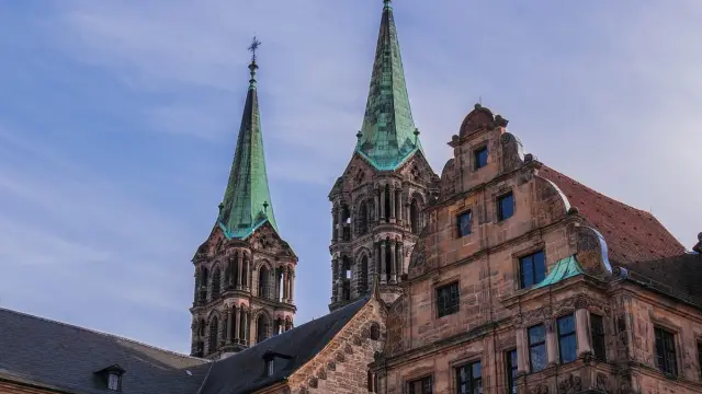
© ChiemSeherin / Pixabay
| State |  Bayern |
|---|---|
| County | independent city |
| ZIP Codes | |
| County Town | Hirschaid |
| Area Code | 0951 |
| License Plate | BA |
| Area | 55 km² |
| Population | 77,150 |
| Population Density | 1,412 inhabitants per km² |
| ZIP Code Areas | |
| Elevation | 262 m |
| Municipality Code | 09461000 |
| Ortstyp | City |
| NUTS-Code | NUTS‑1 DE2 · NUTS‑2 DE24 · NUTS‑3 DE241 |
| Coordinates | ♁49° 54′ N, 10° 54′ O |
| Latitude | 49.891667 |
| Longitude | 10.891667 |
Bamberg is located in Bayern. Currently, 4 postal codes and 1 area codes are stored for the location. The population is 77,150 on an area of 55 km². The first table summarizes the key location data, followed by the map, districts, neighboring locations, and further links to State and County.
Map of Bamberg
The map shows the position of Bamberg based on the stored coordinates.
District statistics
Rent
Building land
Apartment prices
House prices
Living space
Building approvals
New construction
Completions
Construction backlogs
Unemployment rate
Employment rate
Proportion of foreigners
Service
Industry
Self-employed
Part-time
Internal migration
External migration
Divorces
Asylum seekers
GDP
Employed persons
property prices
rent index
Population
Sex
Age
Rent price development
YoY €/m² · 0.00 % · ⌀ 11 €/m²
Source: BBSR/INKAR
| Ø Germany (2024) | 9,39 €/m² |
| Rank among districts | 63 / 400 |
Housing stock by building type (2023)
| One/two-family houses | 22,9 % |
| Multi-family houses | 77,2 % |
Building land prices
YoY €/m² · +361.48 · 361 €/m²
Source: BBSR/INKAR
Purchase price index for condominiums
YoY -1.90 % · 98.1
Source: Destatis Häuserpreisindex · Rural districts with urbanization tendencies
Purchase price index for single/two-family houses
YoY +0.20 % · 100.2
Source: Destatis Häuserpreisindex · Rural districts with urbanization tendencies
Living space per inhabitant
YoY m² · -0.13 % · 47.8 m²
Source: BBSR/INKAR
Building approvals for new apartments
YoY per 1,000 inhabitants · +35.69 % · 4.4 per 1,000 inhabitants
Source: BBSR/INKAR
Completed apartments in new buildings
YoY per 1,000 inhabitants · -9.38 % · 4.3 per 1,000 inhabitants
Source: BBSR/INKAR
Completed apartments per stock
YoY per 1,000 apartments · -9.08 % · 7.3 per 1,000 apartments
Source: BBSR/INKAR
Construction backlogs (approved, not completed)
YoY +3.00 % · 207.4
Source: BBSR/INKAR
Unemployment rate
YoY % · +2.57 % · 4.4 %
Source: BBSR/INKAR
Employment rate
YoY % · +0.40 % · 84.8 %
Source: BBSR/INKAR
Proportion of foreigners
YoY % · +3.10 % · 17.6 %
Source: BBSR/INKAR
Service sector rate
YoY % · -0.57 % · 79.6 %
Source: BBSR/INKAR
Industry rate
YoY % · -2.38 % · 31.5 %
Source: BBSR/INKAR
Self-employment rate
YoY % · -9.69 % · 6.2 %
Source: BBSR/INKAR
Part-time employees
YoY % · +1.91 % · 34.8 %
Source: BBSR/INKAR
Internal migration balance
YoY -118.45 % · -77.1
Source: BBSR/INKAR
External migration balance
YoY +29.59 % · 88.6
Source: BBSR/INKAR
Divorces
YoY +24.65 % · 1.8
Source: BBSR/INKAR
Asylum seekers as a proportion of the population
YoY % · +10.05 % · 8.8 %
Source: BBSR/INKAR
Gross domestic product
YoY Mio. € · +1.96 % · 5,285 Mio. €
Source: BBSR/INKAR
Employed persons
YoY Tsd. · 0.00 % · 76 Tsd.
Source: BBSR/INKAR
house price index
YoY +3.18 % · 152.7
Source: Eurostat
rent index
YoY +2.08 % · 117.9
Source: Eurostat
Population trend of Bamberg
YoY -4.26 % · 77,150
Age groups (district level, source: Destatis) · 2025 · male/female
Places in the County
The table lists the recorded places of this allocation around Bamberg and shows the stored postal code and directly linked place name per row.
Districts of Bamberg
The table shows the recorded districts of Bamberg and assigns the stored postal code to each entry.
Nearby locations
The table lists neighboring places around Bamberg and shows the stored distance.
| Location | Distance |
|---|---|
| Hallstadt | 4 km |
| Stegaurach | 4 km |
| Bischberg | 5 km |
| Gundelsheim | 5 km |
| Memmelsdorf | 6 km |
| Kemmern | 7 km |
| Oberhaid | 7 km |
| Pettstadt | 8 km |


Independent cities
The selection shows larger places from the surrounding area of Bamberg and facilitates direct switching to neighboring location pages.













































